With Realsee, a single Galois M2 capture can now give you both: a hyper‑realistic 16K 3D virtual tour and an AI‑generated 2D floor plan. You scan once, and the system automatically produces the visual assets you need to market and document a property—without traditional field measurements or outsourcing CAD drafting.
This article explains why Galois M2 is the best way to unlock high‑quality AI floor plans, how its 16K imagery and LiDAR accuracy translate into better layouts, and where optional manual refinement fits in for edge‑case projects.
One Scan, Two Deliverables: 16K Tours + AI Floor Plans
Galois M2 is a professional‑grade 3D LiDAR camera designed to capture both geometry and imagery in a single workflow. When paired with the Realsee Console:
-
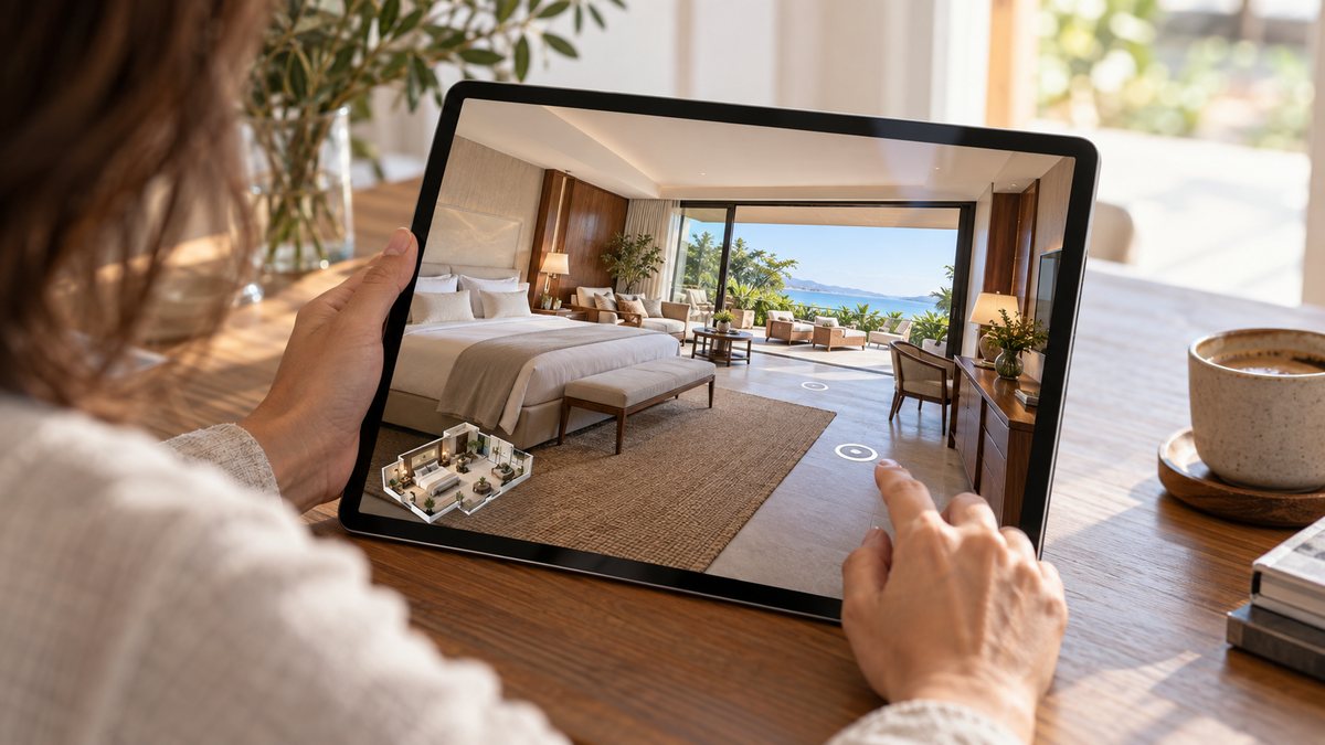
Every capture produces a 16K 3D virtual tour, built from 134‑megapixel panoramas.
-
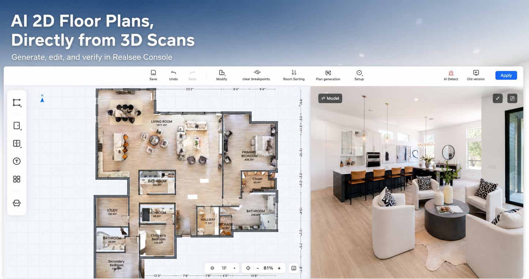
The same spatial data feeds the AI floor plan engine, which automatically generates 2D schematic floor plans of the scanned space.
From a user’s perspective, this means:
-
Realsee reconstructs the 3D space and derives a corresponding floor plan.
-
You refine the floor plan in the Floorplan Editor if needed, then download production‑ready PNG files for free.
The floor plan is not a separate manual deliverable—it is a native product of the LiDAR + 16K capture pipeline.
Why 16K Imagery Matters When Editing Floor Plans
Floor plans are geometric, but editing them is visual. Galois M2 is built around a large 4/3‑inch CMOS sensor that captures high‑dynamic‑range panoramas at 16K resolution (16384 × 8192 pixels), with 5‑exposure HDR per frame.
In practice, this matters for floor plan work in three key ways:
-
Clear verification of openings and boundaries
In the Realsee Floorplan Editor, you edit the 2D layout on the left while viewing the panorama or 3D model on the right. With 16K imagery, doors, windows, columns, and furniture are crisp, so you can confidently match wall segments and openings to the actual space. -
Accurate room labeling and layout decisions
Room functions (living room, kitchen, primary bedroom, study) are easier to identify when you can see how the space is actually used. This makes room naming and partition settings in the editor faster and more reliable. -
Better marketing value from a single capture
The same 16K panoramas that support floor plan editing also power the 3D tour you publish. You get top‑tier visual quality for buyers and tenants, plus floor plans that visually align with what they see in the tour.
High‑resolution imagery does not just look good—it reduces guesswork when adjusting floor plans and ensures that what’s on the plan matches what’s in the tour.
LiDAR Accuracy: The Foundation of Reliable AI Floor Plans
Underneath the 16K imagery, Galois M2 runs a 940 nm Class‑1 Laser LiDAR scanner with the following key characteristics:
-
Scanning radius: 0.2–25 meters
-
Field of view: 360° × 155°
-
Measurement error: < ±20 mm at 10 meters
-
Eye‑safe Class‑1 laser
For AI floor plans, these specs translate directly into quality and efficiency:
-
Precise wall positions and room dimensions
The LiDAR point cloud gives the floor plan engine an accurate representation of walls, doors, and boundaries. With < ±20 mm error at typical interior distances, the system can infer room shapes and sizes with high confidence. -
Robust coverage across entire rooms
A 360° × 155° field of view ensures that vertical and horizontal surfaces are captured in a single station, reducing blind spots and misalignments in the resulting layout. -
Better auto layouts, fewer manual fixes
Because the geometry is clean and dense, the initial AI‑generated floor plan often closely matches the real space. In many projects, users only need minor tweaks—adjusting a door swing, renaming rooms, or fine‑tuning a wall segment—before the layout is ready to download.
The floor plan quality you see is not an accident; it is directly tied to the LiDAR hardware feeding the AI.
Turn Galois M2 Captures into Free Floor Plan Value
One of the most practical advantages of using Galois M2 with Realsee is the way floor plans are delivered and priced.
-
Schematic floor plans are generated automatically from your captures.
-
Floor plan PNG downloads via the Add‑ons section are free—you do not pay extra drafting fees for the floor plan itself.
-
You can capture a property, refine the AI layout in the console, and export multiple floor plans without incremental cost per plan.
For many real estate and AEC teams, this changes the economics:
-
No need to outsource basic floor plans to third‑party drafters.
-
No separate trip for manual measurements—Galois M2 capture becomes your single source of truth.
-
Each scan multiplies into a 16K tour, floor plans, and other deliverables (CAD, point clouds, 3D models) within the same ecosystem.
In short: every Galois M2 project can yield both a premium 3D tour and reusable floor plans at no additional floor plan drafting cost.
Optional Manual Floor Plan Service as a Safety Net
Realsee’s AI floor plans are designed to handle the vast majority of real‑world spaces, especially when captured with Galois M2 under recommended conditions. However, some properties are inherently challenging:
-
Highly irregular layouts
-
Areas with significant occlusion or missing scans
-
Projects with strict presentation or regulatory requirements
For these edge cases, Realsee offers a manual floor plan service: professional drafters review the automatically generated layout against the original 3D scan and refine details where necessary.
This service is:
-
Optional, not the default
-
Intended for high‑stakes or unusual projects
-
A safety net, rather than a replacement for AI
For standard residential and commercial spaces captured with Galois M2, AI‑generated floor plans plus quick console edits are typically sufficient.
How to Get Started: From M2 Capture to Floor Plan Download
If you are ready to turn Galois M2’s 16K LiDAR captures into floor plans, the practical workflow is straightforward:
-
Capture the property with Galois M2
Follow basic capture best practices: scan all indoor areas, maintain enclosed paths, keep doors open and curtains tied back. -
Upload and process in Realsee Console
Let the system reconstruct the 3D tour and generate the initial AI floor plan from the LiDAR point cloud. -
Refine the layout in the Floorplan Editor
Use the dual‑view interface (2D floor plan on the left, panorama/3D on the right) to adjust walls, doors, windows, and room labels. -
Apply and preview the floor plan
Save your changes, configure display options (room names, areas, rulers), and preview the interactive layout. -
Download the schematic floor plan (PNG)
Go to Add‑ons → Instant Floor Plan → Download to export PNG floor plan files for marketing, documentation, and design workflows.
For a detailed console walkthrough, see: