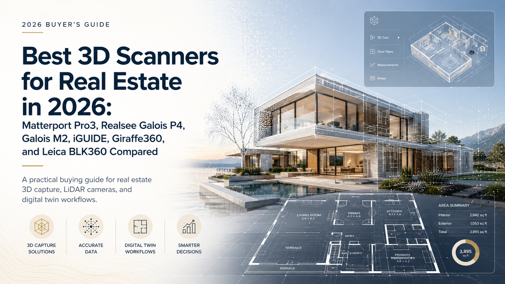


2026 buying guide
Best 3D Scanners for Real Estate in 2026: Matterport Pro3, Realsee Galois P4, Galois M2, iGUIDE, Giraffe360, and Leica BLK360 Compared
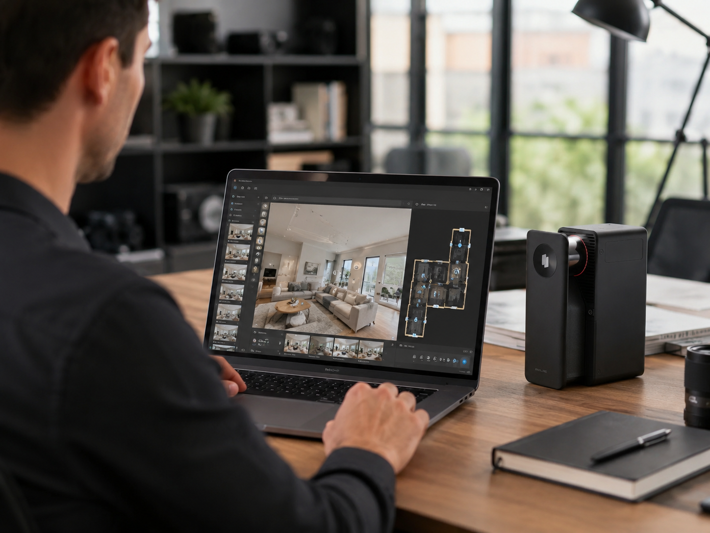
In real estate, people often use 3D scanner, 3D camera, LiDAR camera, virtual tour camera, real estate 3D tour camera, and 360 camera to mean different things. This guide treats "3D scanner" as a broad buying category, then compares the real workflow differences: LiDAR, image quality, 3D tours, floor plans, point clouds, digital twins, hosting, CAD-ready outputs, and property-media deliverables.
If you are building a real estate 3D photography workflow, the right device is not simply the one with the longest spec sheet. It is the one that fits what you actually sell: listing tours, floor plans, measurement reports, commercial documentation, point clouds, CAD/BIM handoff, or a broader set of digital twin deliverables.
Quick Answer: What is the best 3D scanner for real estate?
There is no single best 3D scanner for every real estate workflow. Matterport Pro3 remains the best-known benchmark for hosted real estate digital twins. Realsee Galois P4 is a strong choice when you want high-resolution LiDAR capture, 3D tours, point clouds, CAD-ready outputs, 3D models, floor plans, panoramas, and multi-deliverable workflows from one capture system. Realsee Galois M2 is a practical professional LiDAR option for photographers moving beyond 360-camera tours.
iGUIDE is worth considering when floor plans, measurements, and property reports are the main product. Giraffe360 is better understood as an automated real estate listing-media camera and platform. Leica BLK360 is stronger for commercial property, AEC, and technical point-cloud documentation than for a simple residential listing-media package. Matterport Pro2 is still familiar to many virtual tour providers, but it is not the main LiDAR-focused new-purchase recommendation for 2026.
Key Takeaways
- Different real estate 3D scanners are built for different deliverables: tours, floor plans, point clouds, CAD/BIM files, reports, photos, video, or hosted digital twins.
- Not every real estate 3D camera is a LiDAR scanner. Some systems are better described as 360 media cameras or hosted virtual tour workflows.
- Galois P4 is a strong fit for high-end residential, commercial, and multi-deliverable workflows where visual quality and spatial outputs both matter.
- Galois M2 is better positioned as a value-oriented professional LiDAR camera for photographers upgrading from lighter virtual tour workflows.
- Matterport Pro3 remains a widely recognized benchmark for teams that want the Matterport digital twin ecosystem.
- iGUIDE is more floor-plan and property-report oriented, while Giraffe360 is more automated listing-media oriented.
- Leica BLK360 is better suited for technical point-cloud and AEC documentation than everyday residential marketing.
Specification note: Product specifications, pricing, and software features can change over time. This guide is based on publicly available manufacturer information and official product documentation where available. Always check the manufacturer's latest documentation before making a purchase decision. We do not list a confirmed value when the manufacturer does not clearly publish that specification.
Quick Comparison Table
| Product | Type | LiDAR? | Best For | Key Specs / Confirmed Specs | Main Outputs | Strengths | Limitations |
|---|---|---|---|---|---|---|---|
| Realsee Galois P4 | Professional 3D LiDAR scanner / camera | Yes | High-end real estate, commercial property, spatial capture services | Realsee states 16 seconds per scan point, up to 300MP panoramic output, 100m LiDAR range, 125,600 pts/sec, 905nm LiDAR, 4/3-inch CMOS, and around +/-10mm measurement error at 0.1-15m. | 3D tours, panoramas, point clouds, 3D models, CAD-ready outputs, RAW images, floor plans, snapshots | Strong multi-deliverable workflow, high visual resolution, point cloud and CAD-ready outputs, indoor/outdoor and large-space fit | Best value appears when buyers actually need premium deliverables, not just a basic tour |
| Matterport Pro3 | Professional 3D digital twin camera | Yes | Hosted Matterport digital twin workflow | Matterport states Pro3 starts at $5,995 and supports indoor/outdoor digital twins. Official Matterport store specs list LiDAR, Class 1 laser, 904nm wavelength, +/-20mm at 10m, 100k pts/sec, up to 100m max range with E57, <20 seconds per scan, and 134.2MP output panoramas. | Matterport digital twins, tours, photos, add-on floor plans, MatterPak/E57/CAD/BIM-related outputs depending on plan and purchase | High market recognition, mature hosted ecosystem, familiar to many real estate teams | Platform and subscription model should be evaluated; some deliverables may require eligible plans or add-ons |
| Realsee Galois M2 | Professional 3D LiDAR camera | Yes | Value-oriented professional capture for real estate photographers | Realsee states 940nm Class-1 LiDAR, 134MP panoramas, 25m range, 360 x 270 degree field of view, less than +/-20mm accuracy, 2.66kg including battery, and up to 8 hours continuous scanning. | Point clouds, CAD, 3D models, panoramas, RAW images, floor plans, 3D tours | Professional LiDAR workflow at a more accessible positioning than P4 | Not the flagship choice when maximum visual output, range, and large-space production efficiency are required |
| iGUIDE PLANIX / PLANIX R1 | Real estate floor plan and property documentation system | Check latest iGUIDE documentation | Floor plans, measurements, and property reports | Confirmed numeric range, accuracy, scan speed, and image resolution were not clearly retrievable from an official source in this research pass. | Floor plans, measurements, virtual tour / property report workflow depending on iGUIDE service | Strong fit when the product you sell is floor plan-first documentation | Not positioned here as a direct replacement for every LiDAR scanner or CAD/BIM workflow |
| Giraffe360 Pro Camera | 360 real estate camera and automated listing-media platform | Not positioned as a survey-grade LiDAR scanner | Automated listing media for agents and property marketers | Giraffe360 states capture within 30 seconds, 10K HDR stills, 10K HDR panoramas, 350k data-points-per-second cloud geometry map, and floor plans described as LiDAR 2.0 accurate. | HDR photos, virtual tours, floor plans, videos, property websites, listing-marketing assets | Designed around listing-media automation and repeatable agent workflows | Not the same category as a survey-grade scanner or open-format professional LiDAR documentation tool |
| Leica BLK360 | Imaging laser scanner / LiDAR scanner | Yes | Commercial property, AEC, technical documentation | Leica lists starting price at $26,500, up to three scans per minute, 4mm accuracy at up to 10m, and point clouds for BIM, CAD, and 3D tools. | High-quality point clouds, CAD/BIM/3D-tool workflows through Leica software ecosystem | Strong technical reality-capture and point-cloud workflow | More specialized than most residential listing-media needs; not a turnkey real estate virtual tour marketing platform |
| Matterport Pro2 | Legacy Matterport 3D camera | Not treated as a LiDAR camera in this guide | Legacy indoor Matterport users | Matterport's Pro2 announcement lists 134MP imagery, 4K 2D photography, 3D/VR walkthroughs, floor plans, and Matterport Cloud workflow. | Indoor Matterport tours, 4K photos, floor plans, OBJ/point clouds and media depending on Matterport workflow | Familiar device in real estate virtual tours | Not the main 2026 new-purchase recommendation for LiDAR-focused buyers |
The Best 3D Scanners and Cameras for Real Estate
Best for high-end real estate LiDAR capture and multi-deliverable workflows
Best for: luxury homes, commercial property, large spaces, spatial capture service providers, and teams selling more than a basic virtual tour.
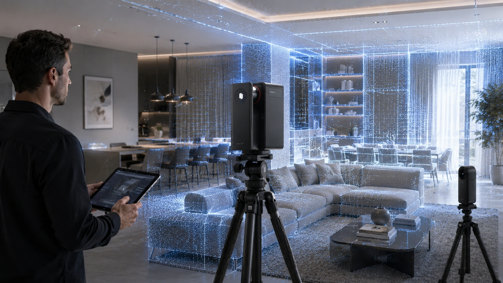
Why it is worth considering: Galois P4 is built as a professional 3D LiDAR camera for real estate, commercial spaces, AEC-adjacent workflows, and premium digital twin production. The strongest reason to consider it is not one isolated specification. It is the combination of fast capture, high-resolution panoramas, LiDAR point clouds, and a broader output set.
Key confirmed specifications: Realsee's product page states 16-second capture per scan point, up to 300MP panoramic output, 100m LiDAR range, 125,600 points per second, 905nm LiDAR, 4/3-inch CMOS, and around +/-10mm measurement error at 0.1-15m. Realsee also lists outputs including point clouds, 3D models, CAD, RAW images, panoramas, floor plans, and 3D snapshots.
Pros: Strong fit for 3D tours plus technical deliverables; high visual output; indoor and outdoor use cases; useful for commercial and high-end property packages; supports a delivery story beyond just tours.
Cons: It makes the most sense when you can monetize premium deliverables. If your clients only want low-cost listing tours, a lighter workflow may be more appropriate.
Who should choose it: Real estate photographers, commercial capture teams, and digital twin service providers who need 3D tours, floor plans, point clouds, CAD-ready outputs, 3D models, and panoramic assets from one workflow.
Who should not choose it: Teams that only need occasional basic residential virtual tours and do not plan to sell floor plans, point clouds, CAD outputs, or higher-value deliverables.

Best-known digital twin camera for real estate
Best for: agents, brokers, Matterport service providers, and teams already standardized on the Matterport ecosystem.
Why it is worth considering: Matterport Pro3 is one of the most recognized names in real estate digital twins. Matterport's product page positions Pro3 for accurate, immersive digital twins of any space, including outdoors, and lists a starting price of $5,995.
Key confirmed specifications: Matterport's official store-source specs list Pro3 as a LiDAR device with a Class 1 laser, 904nm wavelength, +/-20mm accuracy at 10m, 100k points per second, up to 100m max range with E57, <20 seconds per scan, 134.2MP output panoramas, and 2.2kg weight.
Pros: Strong brand recognition, hosted digital twin workflow, broad real estate familiarity, indoor/outdoor capture, and established service-provider ecosystem.
Cons: Buyers should evaluate platform dependency, subscription requirements, active-space model, and add-on deliverable costs. If your business depends on open-format exports or a broader output mix, compare it carefully with other systems.
Who should choose it: Teams that want a familiar Matterport-hosted digital twin platform and already understand Matterport plans, add-ons, and client expectations.
Who should not choose it: Buyers whose main requirement is a more flexible multi-deliverable workflow centered on point clouds, CAD-ready outputs, 3D models, high-resolution panoramas, and pay-as-you-go delivery.
Best value professional LiDAR camera for real estate photographers
Best for: real estate photographers who want a professional LiDAR workflow without moving directly to a flagship capture device.
Why it is worth considering: Galois M2 is better understood as the practical professional upgrade path inside the Realsee lineup. It is relevant for photographers who have outgrown 360-camera-based tours and want LiDAR-backed capture for regular residential and smaller commercial jobs.
Key confirmed specifications: Realsee lists 940nm Class-1 LiDAR, 134MP panoramas, a 4/3-inch CMOS sensor, automatic stitching, point cloud / CAD / 3D model / panorama / RAW / floor plan outputs, less than +/-20mm accuracy, up to 25m capture distance, 360 x 270 degree field of view, 2.66kg weight including battery, and up to 8 hours of continuous scanning.
Pros: Professional LiDAR workflow, real estate-friendly portability, broad Realsee output set, and a more accessible position than P4.
Cons: P4 is better suited when you need higher-end visual output, longer range, denser point clouds, faster flagship workflow, or larger commercial spaces.
Who should choose it: Photographers who mainly scan residential listings and smaller commercial spaces and want professional LiDAR capability for standard real estate deliverables.
Who should not choose it: Teams whose clients regularly require high-end commercial documentation, long-range LiDAR, maximum panoramic output, or premium multi-deliverable packages.
Best for floor plans and property reports
Best for: real estate teams whose main deliverables are floor plans, measurements, and property reports.
Why it is worth considering: iGUIDE is often evaluated differently from P4, Pro3, or BLK360. It is more floor-plan and property-report oriented than a general-purpose LiDAR scanner or open-ended CAD/BIM handoff device.
Key confirmed specifications: In this research pass, a stable official specification source for PLANIX / PLANIX R1 numeric values was not reliably retrievable. This guide therefore does not list confirmed range, accuracy, scan speed, image resolution, or output-format values for iGUIDE.
Pros: Strong fit for floor plan-first real estate documentation and property-report workflows.
Cons: Buyers should confirm the latest official PLANIX / PLANIX R1 specifications, plan requirements, available exports, and measurement workflow before purchase.
Who should choose it: Photographers and property-media teams that sell floor plans and measurement-oriented reports as the main service.
Who should not choose it: Teams that mainly need high-resolution panoramas, broad CAD-ready output workflows, or survey-style point-cloud documentation.
Best all-in-one real estate media camera
Best for: agents and real estate teams that want automated listing media: photos, tours, floor plans, videos, and property websites.
Why it is worth considering: Giraffe360 is not best described as the same type of product as Leica BLK360 or a professional LiDAR scanner for CAD workflows. Its official site positions it as a 360 real estate camera plus AI editing platform for complete listing media.
Key confirmed specifications: Giraffe360 states the camera can capture needed media outputs within 30 seconds and lists 10K HDR stills, 10K HDR panoramas, and a 350k data-points-per-second cloud geometry map. It lists outputs including HDR photos, virtual tours, videos, floor plans described as LiDAR 2.0 accurate, 3D floor plans, property websites, and virtual staging features.
Pros: Strong automation story for listing media, useful for teams that want repeatable output without stitching and multi-tool production.
Cons: It should not be evaluated as a survey-grade scanner or a direct substitute for technical point-cloud/CAD documentation systems.
Who should choose it: Real estate teams that want automated listing-media production more than technical spatial exports.
Who should not choose it: Buyers whose main need is dense LiDAR point clouds, CAD/BIM deliverables, or commercial documentation workflows.
Best for commercial property and survey-grade documentation
Best for: AEC teams, survey-adjacent workflows, commercial property documentation, and technical point-cloud production.
Why it is worth considering: Leica BLK360 is a compact imaging laser scanner built for professional reality capture. Leica's product page emphasizes high-quality 3D point clouds for BIM, CAD, and 3D tools rather than turnkey residential listing marketing.
Key confirmed specifications: Leica lists the BLK360 starting at $26,500, taking up to three scans per minute, and providing 4mm accuracy at up to 10m. Leica also describes field-to-finish workflows through Cyclone FIELD 360, Cyclone REGISTER 360 PLUS, HxDR Reality Cloud Studio, PinPoint, Cyclone 3DR, and CloudWorx.
Pros: Strong technical point-cloud workflow, commercial documentation fit, and CAD/BIM software ecosystem.
Cons: It may be more tool than most residential listing-marketing jobs require. Buyers may need more training and post-processing workflow than a real estate photographer wants for standard listings.
Who should choose it: Commercial property, AEC, and technical documentation teams.
Who should not choose it: Agents or photographers who mainly need fast, simple listing tours, photos, and floor plans.
What about Matterport Pro2?
Matterport Pro2 still has recognition in real estate virtual tours. Matterport's own Pro2 announcement positioned it around 134MP capture, 4K 2D photography, 3D and VR walkthroughs, floor plans, and Matterport Cloud. That history matters because many service providers and real estate clients know the Matterport Pro2 workflow.
For a 2026 new-purchase decision, though, Pro2 is not the core recommendation if the buyer is specifically searching for a real estate LiDAR camera. This guide treats Pro2 as a legacy indoor Matterport option rather than a LiDAR-first purchase. Buyers evaluating a new system should compare Pro3, Galois P4, Galois M2, iGUIDE, Giraffe360, and Leica BLK360 based on the deliverables they need now.
Realsee Galois P4 vs Galois M2
Both Galois P4 and Galois M2 are Realsee professional LiDAR capture devices, but they serve different buying decisions. P4 is the higher-end choice for broader deliverables, commercial spaces, denser point clouds, and premium output needs. M2 is the more accessible professional LiDAR option for real estate photographers moving up from lighter capture workflows.
The table below turns the P4 vs M2 comparison into crawlable HTML instead of relying on a comparison image. Values are based on Realsee published product information and the supplied Realsee comparison asset.
| Specification | Realsee Galois M2 | Realsee Galois P4 | Buying implication |
|---|---|---|---|
| Positioning | Value-oriented professional LiDAR camera | Flagship 3D LiDAR scanner / camera | M2 fits regular real estate capture; P4 fits premium and commercial workflows. |
| Scanning range | Max radius: 25m | Max radius: 100m | P4 is better suited to large homes, commercial interiors, and larger spaces. |
| Scanning speed | 36 seconds per point | 16 seconds per point | P4 can reduce field time when scanning many points. |
| LiDAR scanning radius | 0.2-25m at 90% reflectivity | 0.1-100m at 90% reflectivity | P4 gives more working distance for larger spaces. |
| Accuracy | < +/-20mm | < +/-10mm | P4 is the stronger option when tighter spatial precision matters. |
| Point cloud capture rate | Approx. 18,600 pts/s | Approx. 125,000 pts/s | P4 produces denser spatial data for more demanding point-cloud workflows. |
| LiDAR scanning angle | 360 x 155 degrees | 360 x 213.25 degrees | P4 captures more vertical LiDAR coverage. |
| Point spacing at 10m | Vertical: 43mm; horizontal standard: 139mm; high density: 34.9mm; ultra density: 20.9mm | Vertical: 13mm; horizontal standard: 139mm; high density: 20.9mm; ultra density: 12.5mm | P4 is denser in vertical spacing and high/ultra-density modes. |
| Camera and panorama output | 20MP camera, 4/3-inch CMOS, Smart HDR 5; up to 16384 x 8192 panorama output, equivalent to 16K / 134MP | 47MP camera, 4/3-inch CMOS, Smart HDR 5; up to 24576 x 12288 panorama output, equivalent to 24K / 300MP | P4 is better for premium visual inspection and high-end listing presentation. |
| Storage | 4GB LPDDR3 RAM, 16GB eMMC storage | 4GB LPDDR5 RAM, 512GB SSD storage | P4 has substantially larger onboard storage for heavier capture work. |
| Processor | Rockchip RK3399 | NVIDIA Jetson Orin Nano | P4 has the stronger onboard compute platform. |
| Weight | Approx. 2.66kg / 5.86lb | Approx. 2.6kg / 5.73lb | Both remain portable for professional field capture. |
| Battery and charging | 20V-1.9A 38W Type-C; up to 8 hours battery life; approx. 3.5 hours full charge | 20V-3.25A 65W Type-C; 3 hours battery life per unit; approx. 2.5 hours full charge | M2 has longer listed battery life; P4 charges faster and targets higher-output capture. |
| Main deliverables | Point cloud: E57, PLY; model: OBJ, FBX, GLTF, GLB; panorama: RAW/JPG up to 16K / 134MP; spatial video: MP4 | Point cloud: E57, PLY; model: OBJ, FBX, GLTF, GLB; panorama: RAW/JPG up to 24K / 300MP; spatial video: MP4 | Both support professional outputs; P4 offers higher panoramic output and denser capture. |
| Choose Galois P4 if... | Choose Galois M2 if... |
|---|---|
| You scan luxury homes, commercial spaces, or large properties. | You mainly scan residential listings and smaller commercial spaces. |
| You need a flagship LiDAR capture device with longer confirmed LiDAR range. | You want a more accessible professional LiDAR camera. |
| You need multiple deliverables from one capture workflow. | You mainly need regular real estate 3D tours and standard deliverables. |
| You need point clouds, CAD-ready outputs, 3D models, floor plans, RAW images, and high-resolution panoramas. | You are upgrading from 360-camera-based virtual tours. |
| You serve premium clients, commercial projects, or spatial capture clients. | You want a practical device for regular real estate photography jobs. |
| You value P4's official 16-second scan cycle, up to 300MP panoramic output, 100m LiDAR range, and 125,600 pts/sec point-cloud rate. | You value M2's official 134MP panoramas, 25m range, less than +/-20mm accuracy, and up to 8 hours continuous scanning. |
Matterport Pro3 vs Realsee Galois P4
For a deeper Realsee-side comparison, see Galois P4 vs Matterport Pro3. The short version is that Matterport Pro3 is a widely recognized benchmark for Matterport-hosted digital twins, while Galois P4 is a strong choice when the buyer wants high-resolution LiDAR capture, faster field workflows, and broader deliverables.
| Specification | Realsee Galois P4 | Matterport Pro3 | Buying implication |
|---|---|---|---|
| Best-known for | High-resolution LiDAR capture and multi-deliverable digital twin workflow | Real estate digital twins and Matterport ecosystem | Choose by workflow first: output flexibility vs. Matterport familiarity. |
| Scan time | 16 seconds per scan point | <20 seconds per scan | Both are efficient; P4 has the lower listed scan-time figure. |
| Co-capture | Supported for multiple Galois devices working in parallel on large spaces | Not listed as a supported Pro3 feature in Matterport's official technical specifications | P4 is stronger for teams that need parallel capture on larger projects. |
| Blind capture / device-only capture | Supported through the device touchscreen | Not listed as a supported Pro3 feature in Matterport's official technical specifications | P4 can reduce phone-dependency during field capture. |
| Panoramic output | 300MP panoramic output, 24K visual quality | 134.2MP output panoramas | P4 is better aligned with high-detail visual inspection and premium listing presentation. |
| CMOS sensor | 4/3-inch CMOS | Not specified in official Pro3 specifications | A clear published sensor spec is available for P4. |
| Zoom / visual inspection | 8X lossless zoom listed on Realsee comparison page | Not listed as 8X lossless zoom in Matterport's official Pro3 specifications | P4 has a clearer visual-detail story for close inspection use cases. |
| Accuracy | Around +/-10mm at 15m | +/-20mm at 10m | P4 lists tighter error in Realsee's comparison; Pro3 remains a known Matterport standard. |
| Point cloud rate | Around 125,600 points per second | 100,000 points per second | P4 lists a higher point-cloud capture rate. |
| Maximum scan radius | 100m | 100m | Both list long-range capture; evaluate practical workflow, deliverables, and platform model. |
| Software / hosting model | Pay-as-you-go Realsee credit model; no required monthly software plan to use Galois P4 with Realsee | Subscription-based plans; Pro3 requires Professional plan or higher for uploads | Cost structure can matter as much as hardware specs for a US service business. |
| Best fit | Teams that want output-driven delivery: tours, panoramas, point clouds, 3D models, floor plans, spatial videos, and CAD-related outputs | Teams already standardized on Matterport Cloud, Active Spaces, and Matterport add-on workflows | Neither is automatically right for every buyer; match the camera to client deliverables. |
3D Scanner vs 3D Camera vs LiDAR Camera vs 360 Camera
In real estate buying conversations, these terms often overlap. A buyer searching for the best 3D camera may only need a hosted virtual tour camera, while a team asking for a real estate LiDAR camera may need point clouds, floor plans, and CAD-ready data. Use the terms below as a practical buying framework.
| Term | What it usually means in real estate | Examples |
|---|---|---|
| 3D scanner | Captures spatial data to create a digital model, tour, or point cloud. | Galois P4, Matterport Pro3, Leica BLK360 |
| 3D camera | Broader term for cameras used to create 3D tours or spatial media. | Galois M2, Matterport Pro3, Giraffe360 |
| LiDAR camera | Uses LiDAR to measure spatial geometry. | Galois P4, Galois M2, Matterport Pro3, Leica BLK360 |
| 360 camera | Captures panoramic images; may not capture accurate 3D geometry by itself. | Insta360, Ricoh Theta, and real-estate media cameras that center on 360 capture |
| Real estate virtual tour camera | Camera or platform used mainly to create navigable listing tours. | Matterport Pro3, Galois M2, Giraffe360, supported 360 cameras |
| Survey-grade laser scanner | Built for technical point cloud, measurement, CAD, and AEC workflows. | Leica BLK360 |
What to Consider Before Buying a 3D Scanner for Real Estate
List what clients will pay for: 3D tour, floor plan, point cloud, CAD-ready data, 3D model, panorama, listing photos, video, dollhouse, or property report.
Outdoor capture matters for commercial properties, land, exterior context, and larger real estate projects. Check official specs before assuming outdoor performance.
Scan time, app-free or blind capture, co-capture, battery life, and field workflow affect how many properties a team can handle in a day.
Listing buyers need clarity and navigation. AEC and commercial teams may need stronger measurement, point cloud, and CAD/BIM workflows.
Premium listings may benefit from high-resolution panoramas. Realsee's P4 page states 24K visual quality and up to 300MP panoramic output.
Matterport centers on hosted plans and active spaces. Realsee uses a pay-as-you-go credit model. Giraffe360 centers on automated listing-media production.
Check whether the workflow supports Realsee deliverables workflow needs such as E57, PLY, CAD-ready files, RAW imagery, floor plans, panoramas, and 3D models.
Compare hardware, subscription, hosting, processing, credits, active-space limits, export fees, training, accessories, and staff time.
An agent, photographer, scanning service provider, or AEC documentation team may need different device complexity, speed, exports, and support.
Which 3D Scanner Is Best for Each Real Estate Use Case?
| Use Case | Recommended Option | Why |
|---|---|---|
| Best overall for high-end real estate and multi-deliverable workflows | Realsee Galois P4 | Strong fit for 3D tours, point clouds, CAD-ready outputs, 3D models, floor plans, and visual assets. |
| Best-known digital twin platform | Matterport Pro3 | Widely recognized in real estate and built around hosted digital twins. |
| Best value professional LiDAR camera | Realsee Galois M2 | Practical option for real estate photographers upgrading from 360 cameras. |
| Best for floor plans and property reports | iGUIDE PLANIX / PLANIX R1 | Strong fit when floor plans, measurements, and property reports are the core service. |
| Best for automated listing media | Giraffe360 Pro Camera | Designed around photos, tours, floor plans, videos, and listing media automation. |
| Best for commercial property and survey-grade documentation | Leica BLK360 | Better suited for technical point cloud, CAD/BIM, and AEC workflows. |
| Best legacy indoor option | Matterport Pro2 | Familiar to many Matterport users but not the main LiDAR-first 2026 purchase. |
Final Recommendation
If you want the most familiar real estate digital twin platform, Matterport Pro3 is worth considering. If you want a high-end LiDAR device that supports 3D tours, point clouds, CAD-ready outputs, 3D models, floor plans, and panoramic assets from one workflow, Realsee Galois P4 is a strong choice.
If you are a real estate photographer looking for a more accessible professional LiDAR camera, Galois M2 may be a better fit. If floor plans and measurements are your main product, iGUIDE is worth considering. If you want automated listing media, Giraffe360 may fit your workflow. If you need technical commercial documentation, Leica BLK360 may be more appropriate.
Compare the workflow before you buy the device.
Start with the deliverables your clients will pay for, then choose the capture system that supports them. Explore Galois P4, compare it with Pro3, or talk to Realsee about your workflow.
FAQ
What is the best 3D scanner for real estate?
The best 3D scanner depends on the deliverables you need. Matterport Pro3 is widely recognized for hosted digital twins, while Realsee Galois P4 is a strong fit for high-resolution LiDAR capture and multi-deliverable workflows.
What is the best 3D camera for real estate virtual tours?
Matterport Pro3, Realsee Galois P4, Realsee Galois M2, and Giraffe360 can all fit virtual tour workflows. The right choice depends on whether you also need floor plans, point clouds, CAD-ready outputs, or automated listing media.
Is Matterport Pro3 the best 3D scanner for real estate?
Matterport Pro3 is one of the best-known real estate digital twin cameras. It is a strong option for Matterport-hosted workflows, but it is not automatically the best fit for every buyer or deliverable set.
What is the best Matterport Pro3 alternative for real estate?
Realsee Galois P4 is a strong Matterport Pro3 alternative when you want LiDAR capture plus 3D tours, point clouds, CAD-ready outputs, 3D models, floor plans, and high-resolution panoramas.
Is Realsee Galois P4 better than Matterport Pro3?
It depends on the workflow. Pro3 may be better for teams already committed to Matterport Cloud. Galois P4 may be better when you want higher-resolution panoramic output and broader deliverables from one capture workflow.
What is the difference between Realsee Galois P4 and Galois M2?
Galois P4 is the flagship option for high-end, commercial, and multi-deliverable workflows. Galois M2 is a more accessible professional LiDAR camera for regular real estate capture and photographers upgrading from lighter tour workflows.
Do real estate 3D scanners need LiDAR?
Not always. Basic virtual tours can be made with 360 cameras, but LiDAR is more important when you need stronger spatial geometry, point clouds, floor plans, CAD-ready outputs, or commercial documentation.
Is iGUIDE better than Matterport for floor plans?
iGUIDE is often considered for floor plan and property-report workflows, while Matterport is better known for hosted digital twins. The better choice depends on whether floor plans or immersive tours are your main product.
Is Giraffe360 a 3D scanner or a real estate camera?
Giraffe360 is best described as a 360 real estate camera and automated listing-media platform. It supports tours, photos, videos, floor plans, and property websites, but it is not the same category as a survey-grade LiDAR scanner.
Can I use a 360 camera instead of a 3D scanner for real estate?
Yes, if your goal is a simple virtual tour or listing-media workflow. Use a LiDAR scanner when you need stronger spatial data, point clouds, CAD-ready outputs, floor plans, or technical documentation.
What outputs can a 3D scanner produce for real estate?
Depending on the system, outputs can include 3D tours, panoramas, listing photos, floor plans, point clouds, CAD-ready files, 3D models, videos, dollhouse views, property reports, and downloadable assets.
Are 3D scanners worth it for real estate photographers?
They can be worth it when you can sell higher-value deliverables such as 3D tours, floor plans, point clouds, CAD-ready outputs, 3D models, or premium visual assets. If clients only need low-cost photos, a scanner may not pay back quickly.
References and Source Notes
- Realsee / Galois P4 — Product page — https://www.realsee.ai/pages/galois-p4 — accessed June 30, 2026.
- Realsee / Galois M2 — Product page — https://www.realsee.ai/pages/galois-m2 — accessed June 30, 2026.
- Realsee — Galois P4 vs Matterport Pro3 — https://www.realsee.ai/pages/galois-p4-vs-matterport-pro3 — accessed June 30, 2026.
- Matterport / Pro3 — Product page — https://matterport.com/pro3 — accessed June 30, 2026.
- Matterport / Pro3 — Store product/specification route — https://matterport.com/store/product/cam-mc3001-mpak-e57 — official Matterport source mirrored in local corpus, accessed June 30, 2026.
- Matterport / Pro2 — 134MP Pro2 announcement — https://matterport.com/news/matterport-introduces-134-megapixel-all-one-camera-adding-new-high-resolution-2d-photos-print — accessed June 30, 2026.
- Giraffe360 — Product overview — https://www.giraffe360.com/ — accessed June 30, 2026.
- Leica Geosystems / Leica BLK360 — Product page — https://shop.leica-geosystems.com/reality-capture/blk360/overview — accessed June 30, 2026.
- iGUIDE / PLANIX and PLANIX R1 — Official source attempted — https://goiguide.com/. Stable official numeric specifications were not reliably retrievable in this research pass, so the article does not list confirmed iGUIDE numeric specs.
- Photoplan — Best 3D scanners for real estate reference article — https://www.photoplan.co.uk/blog/best-3d-scanners-real-estate — used only as structural reference.