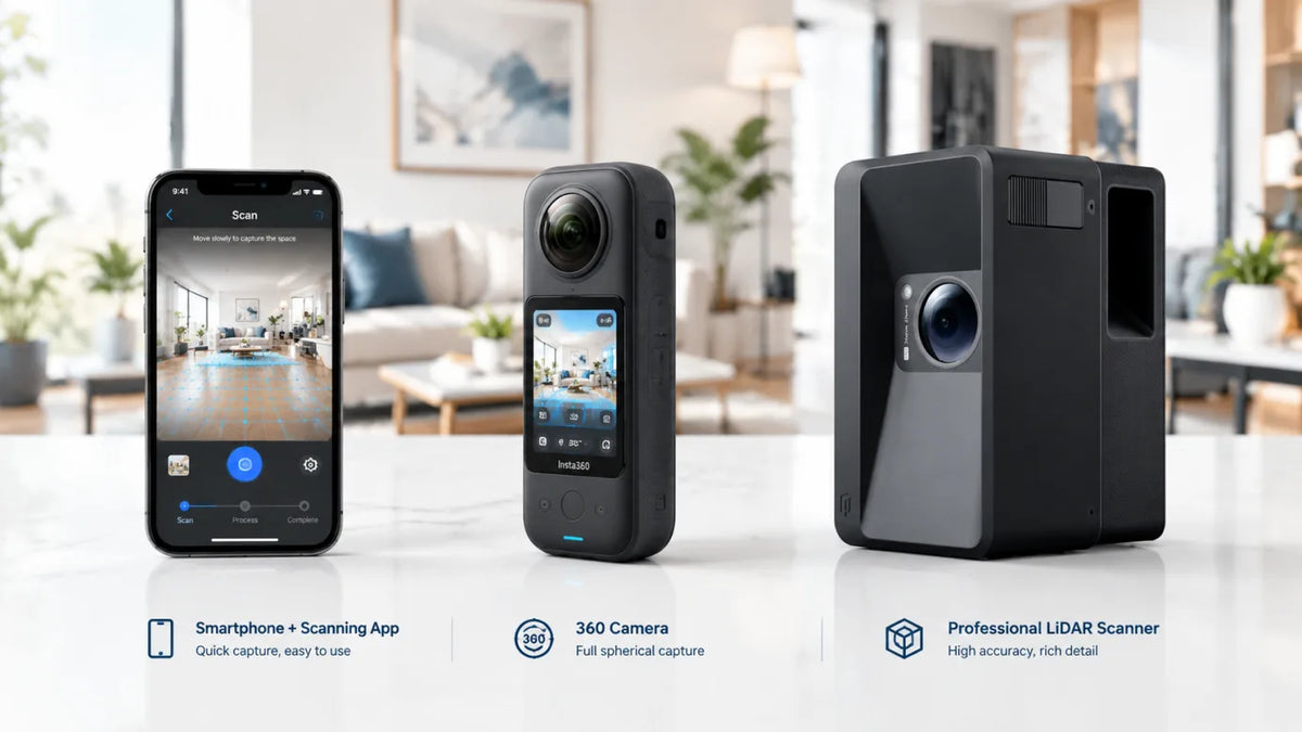
Shopping for a lidar scanner in 2026 comes down to three questions: how accurate does the scan actually need to be for your work, what do you get to keep and use afterward, and what’s the real cost once you add the camera price to whatever software or subscription it requires. This guide covers what a lidar scanner does, where different industries actually use one, what to look for before you buy, and which models make sense for real estate work right now.

What Is a LiDAR Scanner?
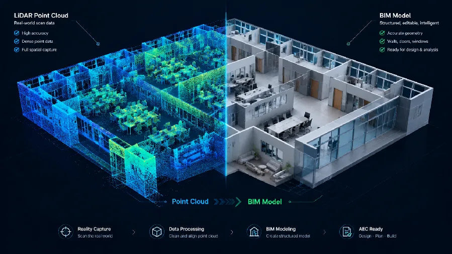
A lidar scanner measures physical space by firing laser pulses at a surface and timing exactly how long the light takes to bounce back. Do that thousands of times a second and you get a point cloud, a dense map of precise 3D coordinates instead of a flat photo. That’s the core difference from a regular camera: a photo shows what a room looks like, a lidar scan tells you the actual dimensions, distances, and shape of it.
For real estate and construction work, that distinction is the whole point. A floor plan generated from lidar data reflects real measurements, not an estimate from a wide-angle photo. If you want the fuller technical breakdown, including how lidar scanners compare to 360 cameras, see our guide on what a lidar scanner is.
Use Cases: Why Different Industries Need a LiDAR Scanner
Real estate. Accurate floor plans and 3D tours let buyers evaluate a property’s actual layout before booking a showing, which cuts down on low-intent visits and speeds up serious offers. For a real estate agent, this has become a core part of real estate marketing: scans fast enough for daily use, precise enough to trust, and useful across every listing channel.
AEC (architecture, engineering, construction). Teams use lidar point clouds to document as-built conditions, plan renovations against real measurements instead of outdated blueprints, and build a digital twin that downstream modeling software, like BIM tools, can work from directly instead of starting over.
Museums and hospitality. An immersive virtual tour built from a lidar scan lets visitors explore a space before they arrive, whether that’s a hotel suite or a museum virtual tour of a gallery. It also doubles as a digital preservation record for spaces that change over time, like a rotating exhibit or a seasonal venue layout.
Facility management. Facility teams use lidar scans to keep an up-to-date map of a building. This map helps with planning space, tracking maintenance, and training new staff on a large site without walking them through it every time.

What to Look for When Buying a LiDAR Scanner
Not every spec on a data sheet matters equally once you’re actually using the camera day to day.
Range and accuracy for your actual property sizes. A scanner rated for a 25-meter range with sub-inch accuracy is overkill for a two-bedroom condo and undersized for a warehouse. Match the spec to what you’ll scan most, not the largest number on the page.
Output formats you can actually use. Check whether the scanner exports usable point cloud formats, CAD files, and auto-generated floor plans, or whether you’ll need extra software just to make the raw data usable. Realsee lists every file a single scan produces so you can compare that against what another platform hands back.
Capture workflow. A single-operator, no-app scanning process means you can shoot a property solo. A workflow that needs a second person or a tethered laptop adds cost and scheduling friction to every job.
The real cost, not just the sticker price. A cheaper camera with a mandatory monthly subscription can cost more over a year than a pricier one with pay-as-you-go credits. Before comparing lidar scanner prices, add up what a typical month of use actually costs on each platform.
Best LiDAR Scanners for Real Estate in 2026
A LiDAR camera does two things in real estate: it captures the exact shape and size of a property, and it creates digital files you can use across every marketing channel. For a closer look at how photographers should choose between 360 cameras, LiDAR cameras, and 3D scanners [4], see this side-by-side breakdown. Here is how the top options compare. For a wider field that also covers Leica BLK360 and other survey-grade units, see our guide to the best 3D scanners for real estate.
| Camera | Type | Best For | Key Specs | Main Outputs |
|---|---|---|---|---|
| Realsee Galois P4 | Professional LiDAR camera | Architects, engineers, and construction teams | 905nm laser, about 125,600 points per second, accurate to ±10mm at 15m, panoramas up to 300MP | 3D tours, point clouds, 3D models, CAD files, floor plans, RAW images |
| Realsee Galois M2 | Easy-to-use professional LiDAR camera | Real estate agents and photographers moving up from a 360 camera | 940nm laser, 0.2 to 25m range, accurate to ±20mm at 10m, 134MP panoramas | 3D tours, point clouds, 3D models, CAD files, floor plans, RAW images |
| Matterport Pro3 [1] | LiDAR-enabled 3D camera | Teams that already use Matterport software | Enterprise API, Dollhouse view, and strong support for Revit software | MatterPak, CAD, BIM files (plan-dependent) |
| iGUIDE PLANIX R1 [2] | Floor plan and measurement camera | Floor plans, measurements, and property reports for agents and appraisers | 40m range, 0.5% or better floor plan accuracy, about 2,500 sq ft in under 15 minutes | Floor plans, measurement reports |
| Giraffe360 [3] | Automated 360 virtual tour camera | Creating listing photos and tours fast, for many properties at once | 10K HDR panoramas, 50m range, about 2,000 sq ft in under 20 minutes | 360 virtual tours, HDR stills |
Out of this whole group, the Realsee Galois M2 and Galois P4 stand out for real estate work. Both are a great value for a real estate agent or a photographer building a real estate marketing business around 3D capture. The M2 is built for virtual tours. It is fast enough for daily listings, priced for one person working alone, and light enough to carry without a crew. The Galois P4 is the more advanced option. It is built for the higher accuracy and bigger files that architecture and construction teams need. For most real estate work, the M2 is the better choice. The P4 makes sense when a job needs extra precision or a full, detailed point cloud.

Here is what those numbers mean in real life. An 8-hour battery gets you through a full day of listings with no charging breaks. A scan range of 0.2 to 25 meters covers everything from a small bathroom to a big open living room. And 5-exposure HDR panoramas capture detail in both bright windows and dark corners, so photos are ready to post without extra editing.
For real estate work specifically, two cameras come up most often: the Realsee Galois M2 and the Matterport Pro3.
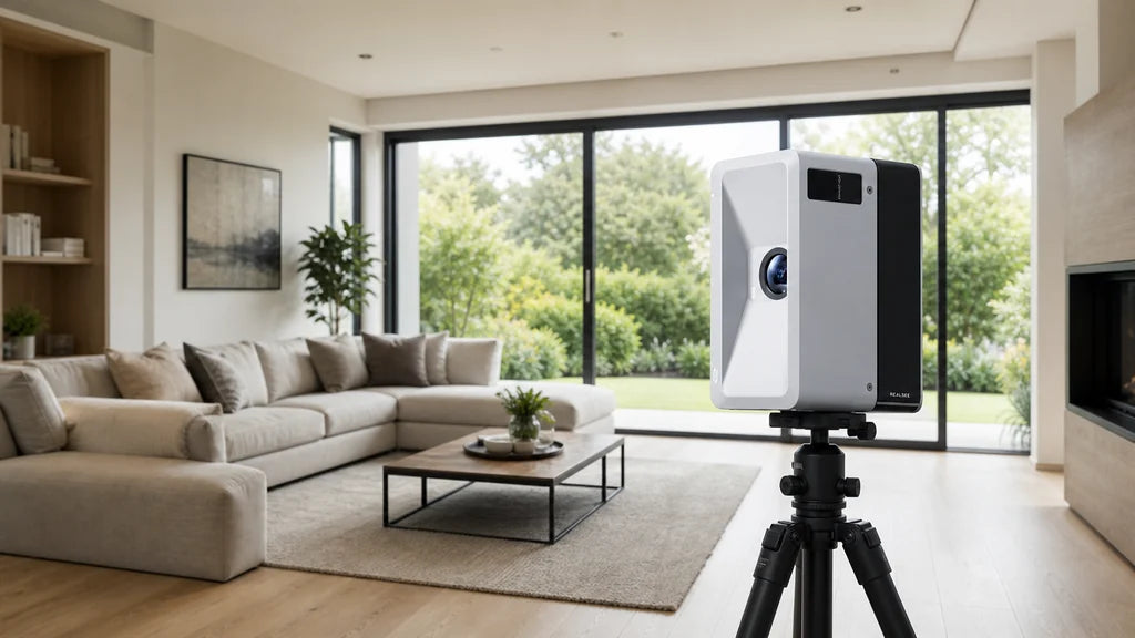
Realsee Galois M2 is built around a 940nm Class 1 laser with a 0.2 to 25-meter scanning range and a 360° x 155° field of view, accurate to within ±20mm at 10 meters. It captures 16K, 134-megapixel panoramas through a 4/3-inch CMOS sensor with 5-exposure HDR, and a single charge covers up to 8 hours of continuous scanning. Every scan can export as point clouds, 3D models, CAD files, panoramas, RAW images, floor plans, and 3D snapshots. The Standard Kit is priced at $2,999 (down from $5,499), and the Premium Bundle, which adds credits, an extra battery, and an upgraded tripod, is $3,799 (down from $6,424).
Matterport Pro3 starts at $3,995 for the camera alone [1], and using it fully requires a Professional plan or higher, billed by how many “Active Spaces” you’re running. That’s the core difference worth weighing: M2’s Realsee Credits work pay-as-you-go, buy more and the per-project cost drops, with no mandatory monthly plan. Matterport’s model is subscription-based by design, which makes sense for teams already standardized on it, but adds an ongoing cost that a pay-as-you-go model doesn’t.
| Realsee Galois M2 | Matterport Pro3 | |
|---|---|---|
| Camera price | $2,999 (Standard Kit) | Starting at $3,995 |
| Software model | Pay-as-you-go Realsee Credits, no subscription needed | Needs a subscription plan for full features |
| Deliverables | Point clouds, CAD, floor plans, RAW images, downloadable and yours to keep | MatterPak, CAD, BIM files available, may require an eligible plan and added fees |
To be fair to Matterport, its Dollhouse view, deep Revit integration, and enterprise API are genuinely stronger for teams already running BIM-heavy workflows, and its brand recognition still carries weight with larger accounts. But if the priority is a lower upfront cost, no forced subscription, and deliverables you can download and use without being tied to one platform, M2 is the more straightforward buy.
Which LiDAR Scanner Is Right for You?
If you’re a real estate photographer or a small team that wants to keep cost per listing down and own your data outright, the Galois M2 covers the vast majority of residential and small commercial jobs. The capture-to-delivery workflow behind that is laid out in the Real Estate Photographer solutions.
If you’re a brokerage looking to standardize 3D tours across an agent team without buying hardware for everyone, the lightweight capture options covered in the Real Estate Brokerage solutions are the better starting point.

Get Started with the Galois M2
If keeping cost per listing down and owning your own data matters more than deep BIM integration, the Galois M2 Standard Kit is built for exactly that, starting at $2,999 with no monthly subscription required. See the full specs on the Galois M2 product page, or go straight to the Standard Kit listing to get started. Buying for a team, or not sure which kit fits your job mix? Talk to the Realsee team first.

FAQs
Q1: What’s the difference between a lidar scanner and a 360 camera?
A lidar scanner captures precise measurements and spatial data along with imagery, so it can generate accurate floor plans and point clouds. A 360 camera captures visual panoramas only, with no dimensional data behind them, which is fine for a quick walkthrough but not for anything that needs real measurements.
Q2: How much does a lidar scanner cost?
Entry-level and mid-range lidar scanners for real estate typically run $2,500 to $4,000 for the camera itself, and that’s before factoring in whether the platform requires an ongoing subscription. The Galois M2 Standard Kit is $2,999 with no mandatory monthly plan.
Q3: Is a lidar scanner worth it for real estate photography?
Yes, for anyone doing this regularly. Properties marketed with a 3D tour and accurate floor plan see meaningfully more engagement and fewer wasted showings than photo-only listings, and a lidar scanner is what makes both of those deliverables possible from a single site visit.
Q4: Can I use a lidar scanner without paying a monthly subscription?
It depends on the platform. Realsee’s Galois M2 runs on pay-as-you-go credits with no mandatory subscription, while other major platforms like Matterport require an active Professional plan to unlock full functionality.
Q5: What file formats does a lidar scanner export?
A good lidar scanner should export point clouds, CAD files, floor plans, and high-resolution panoramas at minimum. The Galois M2 exports all of these plus 3D models, RAW images, and 3D snapshots from a single scan, all downloadable rather than locked to one platform.
Sources
[1] Matterport. Pro3 3D camera product page. Accessed 2026-08-26. https://matterport.com/pro3
[2] iGUIDE. PLANIX R1 camera specifications. Accessed 2026-08-26. https://goiguide.com/
[3] Giraffe360. Camera specifications and capture times. Accessed 2026-08-26. https://www.giraffe360.com/
[4] What Digital Camera. Best 3D cameras for real estate virtual tours: how photographers should choose between 360 cameras, LiDAR cameras and 3D scanners. Accessed 2026-08-26. Article link