When a fire, flood, earthquake or severe storm damages a property, recovery teams need reliable information before cleanup changes the site.
Contractors, adjusters, architects, engineers and property owners may all need to understand the same damaged space. Traditional photographs can capture individual details, but they do not always show how those details relate to the rest of the property.
Realsee helps teams create an immersive digital record of the site. A single scan can support visual documentation, remote walkthroughs, measurements, floor planning and professional outputs—without requiring a fixed monthly subscription.
Why 3D scanning matters after a disaster
Conditions can change quickly during disaster recovery. Standing water may be removed, damaged materials may be demolished and unsafe areas may become inaccessible.
Capturing the property early creates a digital reference that teams can revisit throughout the restoration process.
A 3D scan can help teams:
-
Document visible damage before cleanup begins
-
Record rooms, structures, equipment and contents in context
-
Give remote stakeholders access to an immersive walkthrough
-
Reduce unnecessary return visits
-
Support reconstruction planning with spatial information
-
Compare conditions before, during and after restoration
-
Maintain a clearer record of completed work
A Realsee virtual tour does not replace a professional structural assessment, environmental inspection or engineering survey. It provides a detailed visual and spatial record that can support those workflows.
Supporting fire, flood, earthquake and storm recovery
Fire and smoke damage documentation
After a fire, the affected property may include burned materials, smoke contamination, damaged building systems and areas exposed during emergency response.
A Realsee scan can capture the overall condition of the property before debris removal and demolition begin. Teams can later revisit rooms virtually, review the location of visible damage and communicate the scope of work with stakeholders who cannot safely enter the site.
High-resolution imagery can also help preserve visual details that may be difficult to identify after cleanup starts.
Flood and water-damage restoration
Flooded properties often change rapidly as water is extracted and walls, floors or cabinets are removed.
Scanning before mitigation creates a record of the original condition. Additional scans can document demolition, drying and reconstruction milestones.
The resulting 3D tour can help restoration professionals communicate which rooms were affected, where materials were removed and how the property changed throughout the project.
Moisture levels, mold conditions and hidden damage still require appropriate testing equipment and qualified professionals.
Earthquake damage assessment
Earthquakes can affect multiple rooms, floors and structural elements across a property. A spatial record makes it easier to understand where visible cracks, displaced finishes and damaged components are located within the building.
Remote specialists can review the digital environment before visiting the property, helping them prepare for a more focused inspection.
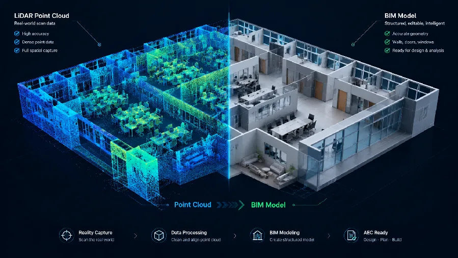
For large or complex sites, point-cloud and CAD outputs may also support architects and engineers as they plan repair or reconstruction work.
Storm and wind-damage recovery
Hurricanes, tornadoes and severe storms can damage roofs, windows, interiors and exterior structures.
Realsee can be used to document accessible indoor and outdoor areas, giving project teams a more complete record of the affected property. The digital tour can then be shared with clients and other authorized stakeholders for remote review.
Get a free Instant Floor Plan
Floor plans are valuable during disaster recovery because they help teams understand room layouts, organize work and communicate the scope of a project.
Realsee offers an Instant Floor Plan at no additional Credit cost for supported projects. Users can quickly obtain, modify and download a floor plan generated from their captured space.
This can help restoration teams:
-
Identify and label affected rooms
-
Organize demolition and reconstruction areas
-
Communicate the project layout
-
Support preliminary material and work planning
-
Give remote stakeholders an easy-to-understand property overview
For projects requiring a professionally drafted and manually verified plan, Realsee also offers a premium Manual Floor Plan service. Manual Floor Plans are separate from the free Instant Floor Plan and may be priced according to the project.
Learn more about available outputs on the Realsee Credits page.
One scan, multiple outputs
Disaster recovery involves more than creating a virtual walkthrough. Different stakeholders may need different forms of project data.
From a single Realsee scan, users can access or request outputs such as:
3D tours
An immersive 3D tour allows authorized stakeholders to revisit the property remotely and understand how damaged areas connect.
Instant and manual floor plans
Use the free Instant Floor Plan for quick layout documentation, or request a professionally drafted Manual Floor Plan when the project requires additional verification and presentation.
CAD
CAD deliverables can support architectural, engineering and reconstruction workflows when teams need editable project documentation.
Point clouds
E57 and PLY point-cloud exports can be used in compatible CAD, BIM and 3D applications for more specialized workflows.
3D models
Exported 3D models can support visualization, planning and collaboration in compatible third-party software.
High-resolution panoramas and RAW images
Panoramas and RAW image files give restoration professionals access to detailed visual material for documentation, presentation and post-production.
Output availability and Credit requirements can vary by device, capture method and project type.
Why pay as you go fits disaster restoration

Disaster restoration work is rarely predictable.
A company may manage several urgent projects after a major storm, followed by a quieter period with fewer active sites. A fixed monthly subscription can create ongoing overhead even when no new disaster recovery projects are available.
Realsee uses a pay-as-you-go model with no monthly subscription. Teams can purchase Credits when projects require them instead of committing to a fixed monthly plan.
Capture, upload, editing, preview and storage are free. Depending on the capture method, Credits may be used for project generation, active 3D tour hosting or selected downloadable outputs.
This model allows restoration businesses to:
-
Match platform costs to active client work
-
Avoid paying a fixed fee during quieter months
-
Add Credits when demand increases
-
Keep selected tours active only when they need to be shared
-
Purchase specialized outputs according to each project’s requirements
Credit usage differs by capture method. For Galois M2, Galois P4 and Poincaré projects, project generation does not consume Credits; Credits are used when keeping a project active for sharing. Other capture methods may use Credits when a project is generated.
See the current options on the Realsee Pay-As-You-Go Credits page.
A practical disaster-recovery scanning workflow
1. Confirm the site is safe
Do not enter a fire-, flood-, earthquake- or storm-damaged property until the appropriate authorities or qualified professionals have confirmed that access is permitted.
Follow requirements for personal protective equipment, contamination control and hazardous environments.
2. Capture the initial condition
Scan accessible areas before cleanup or demolition materially changes the property. Include damaged rooms, relevant transitions and surrounding areas that provide context.
3. Review and organize the project
Upload and preview the scan, check navigation and label important spaces. Add notes or supporting information according to the team’s documentation process.
4. Generate the floor plan
Create the free Instant Floor Plan to provide a clear overview of the property and affected rooms. Request a Manual Floor Plan when a professionally drafted deliverable is needed.
5. Select the required outputs
Choose the deliverables appropriate for the project, such as an active 3D tour, point cloud, CAD file, 3D model, panorama or RAW images.
6. Share with stakeholders
Provide authorized access to contractors, adjusters, property owners, architects or engineers so they can review the site remotely.
7. Capture restoration milestones
Where useful, create additional scans after mitigation, demolition or reconstruction. These captures can form a visual timeline of the project.
Choosing the right Realsee device
The right capture device depends on the size of the property, the required image quality and the intended outputs.
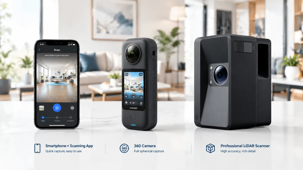
The Galois P4 is designed for professional high-resolution LiDAR capture and complex projects where detailed imagery and spatial documentation are important.
The Galois M2 provides versatile LiDAR-powered capture for indoor and outdoor spaces and may suit restoration professionals who need a balance of portability and professional output.
Teams should select equipment according to the environment, project scale, accuracy requirements and downstream workflow.
Build a clearer record from damage to recovery
Fast, consistent documentation can help disaster-recovery teams preserve information before a site changes.
With Realsee, one scan can become a 3D tour, a free Instant Floor Plan and a foundation for professional outputs such as CAD, point clouds, 3D models and high-resolution imagery.
Most importantly, the pay-as-you-go Credit model gives restoration businesses the flexibility to use the platform when projects arise—without taking on a fixed monthly subscription during quieter periods.
Document the site. Choose the outputs you need. Pay as you go.
Frequently Asked Questions
Can Realsee create a floor plan after a disaster scan?
Yes. Realsee offers a free Instant Floor Plan for supported projects. A premium, manually drafted and verified floor-plan service is also available for projects that require it.
Does Realsee require a monthly subscription?
No. Realsee uses a pay-as-you-go Credit model without a fixed monthly subscription. Credit usage depends on the capture method and selected services.
What outputs can be generated from a Realsee scan?
Depending on the project type, available outputs may include 3D tours, floor plans, CAD, E57 or PLY point clouds, 3D models, high-resolution panoramas and RAW images.
Can Realsee replace a structural inspection?
No. Realsee supports visual and spatial documentation, but it does not replace inspections or assessments performed by qualified engineers, adjusters, environmental specialists or other licensed professionals.
Why is pay-as-you-go useful for restoration companies?
Disaster restoration demand can be seasonal and unpredictable. A pay-as-you-go model helps businesses align platform costs with active projects rather than paying a fixed subscription every month.